| DISTINCTIVE VIEWS of OUR BEAUTIFUL WORLD |
| HOME Art Covered Bridges Lighthouses Military Pirates Railroads Shipwrecks |
|
BELLA TERRA PUBLISHING produces special-interest United States travel maps and guidebooks, whose original watercolor illustrations are available as art prints and notecards. We also offer prints and cards of other contemporary watercolor paintings and vintage art from the 16th to early 20th centuries. All our products are made and assembled in the U.S.A.
Bella Terra Publishing, LLC |
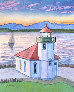
Alki Point Lighthouse, Seattle, Washington © Chris Oldham, from Northwest Lighthouses. | |||
|
Bella Terra® maps, books, posters, art prints and notecards are sold at museum shops, gift shops and bookstores. Buy them online at:
RETAILERS
CLUBS & ASSOCIATIONS | ||
| LATEST RELEASES | |
 |
NEW! RAILS ACROSS AMERICA Vintage School Comic Books Collection of 10 educational comic books produced 1954-1966 by the Association of American Railroads for distribution to schools. Paperback book: 8-1/2x11", retail $24.95. |
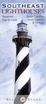 |
SOUTHEAST LIGHTHOUSES Illustrated Map & Guide – 4th Edition Locates all North Carolina, South Carolina & Georgia standing and "lost" lighthouses on a detailed map. Description and history of every standing lighthouse, with directions to each one or the best viewing spots; plus much more. With 25 original watercolor illustrations, 6 new. Size: 24x36". Folded to 4x9", retail $7.95. Laminated poster, retail $19.95. |
 |
NEW HAMPSHIRE COVERED BRIDGES A Traveler's Guide by Eric Riback Up-to-date travel & map guide to all the authentic covered bridges in the Granite State. 110 pages, with 20 black-and-white illustrations. Paperback book: 6x9", retail $9.95. |
 |
LANCASTER COUNTY COVERED BRIDGES A Traveler's Guide by Eric Riback Up-to-date travel & map guide to all the authentic covered bridges in Lancaster County, Pennsylvania. 50 pages, with 7 black-and-white illustrations. Paperback book: 6x9", retail $8.95. |
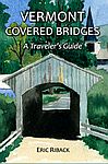 |
VERMONT COVERED BRIDGES A Traveler's Guide by Eric Riback Up-to-date illustrated travel & map guidebook to Vermont’s 100+ authentic covered bridges. 82 pages, with 15 black-and-white illustrations. Paperback book: 6x9", retail $9.95. |
 |
PIRATES Notecards & Matted Art Prints Historical images of noted figures from the Golden Age of Piracy. Classic 18th-century illustrations depict Blackbeard (shown), Bartholomew Roberts, Anne Bonny, Mary Read, and other famous buccaneers. Blank notecard: 5x7", retail $4.00. Print matted to 8x10", retail $10. Print matted to 11x14", retail $15. |
THE GOLDEN AGE OF PIRATES: Historic Art Map Poster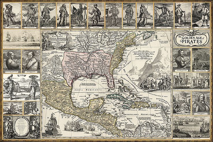 |
||
|
Poster features historic illustrations of 16 noted buccaneers, pirate flags, naval battles and piratical exploits; plus a detailed 1710 map of North America and the Spanish Main. Size: 24x36". Retail $19.95. |
|
P.O. Box 731, Rhinebeck, NY 12572 • tel 845-758-1460 • fax 866-954-6119 • sales@bellaterramaps.com Copyright © 2023. Bella Terra® is a registered trademark of Bella Terra Publishing, LLC |